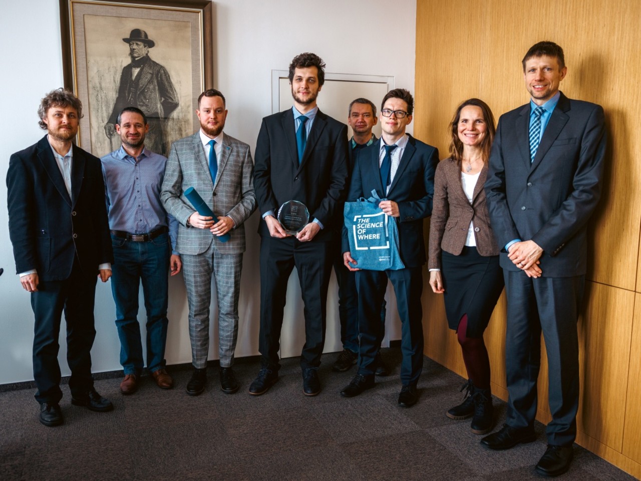
At the largest professional meeting of geoinformaticians in the Czech Republic, GIS Esri in Prague, the Department of Geoinformatics scored with their poster presenting the results of a study focused on investigating the impact of the COVID-19 pandemic on the intensity of night-time lights in the Czech Republic, winning third place.
“Although the use of remote sensing night-time data in connection with COVID-19 is popular, domestic studies with a similar focus have so far been lacking. Our research involved the analysis and visualization of night-time satellite imagery. Specifically, we monitored the variability of night-time intensity before and during the coronavirus restrictions. Particularly during the peak of the pandemic, the restrictions had a significant impact on social and economic life in the Czech Republic, as well as in other countries around the world,” said Daniel Pavlačka, lead author of the poster.
The results of the analyses show that there was a significant decrease in light intensity during the COVID-19 pandemic, significantly lower in the Czech Republic in 2020 than in the previous year. Restrictions on movement and activities in larger cities led to a clear decrease in lighting intensity in their centres, while in peripheral and less populated areas the differences were not so great. “This disparity can be explained by strong constraints in services, industry, transportation, and social events, which tend to be concentrated in large and densely urbanised areas. Moreover, the results of the study can be used to retrospectively assess how strictly the restrictions have been observed in each region and how the behaviour of the local population has changed in line with the measures imposed,” added Pavlačka on the analyses carried out.
According to Jaroslav Burian, another poster author, the Department of Geoinformatics managed to convey the results also in the form of maps. “This research within our department brought together specialists in remote sensing data processing, spatial analysis, and geovisualization. I appreciate that the idea for this area of research came from PhD students in a situation where this topic is not directly related to any of their dissertations. It was extra work for them,” added Burian.
The GIS Esri conference is one of the most important events in the field of geoinformatics and cartography in the Czech Republic. “This year it was attended by more than a thousand experts from all fields, including universities, private companies, and state institutions. We therefore greatly appreciate the award, because among other reasons, the results of our research have reached the wide professional public,” added Burian.
The research was published last year under the title “Influence of COVID-19 on night-time lights in Czechia” in the Journal of Maps, an important platform for researchers in geography and geoinformatics with an emphasis on geovisualization. The article is available together with the maps at https://www.tandfonline.com/doi/full/10.1080/17445647.2023.2235381